A world-class mountain bike ride on two ridges in the superb surroundings of the Southern Cairngorms National Park with 360 degree views over mountains and deep glens, and a final section through woodland past the beautiful Auchintaple Loch. Best enjoyed on clear and calm days, as the majority of the route is very exposed.
Suitable for: Mountain bikes (or very experienced gravel bike riders)
This old Droving route starts at the Bridge of Forter, north of Kirkton of Glenisla and Folda, which both provide alternative parking if needed. After a gate the route uses a landrover track on the eastern side of the River Isla, passing a few houses along the way to Linns. Here a bridge crosses the river just north of Auchavan, and after a short section through a woodland the route follows a gravel path north.
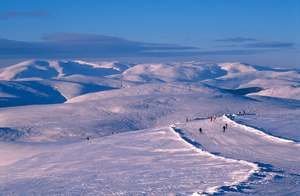
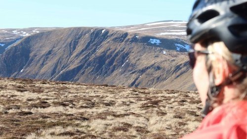
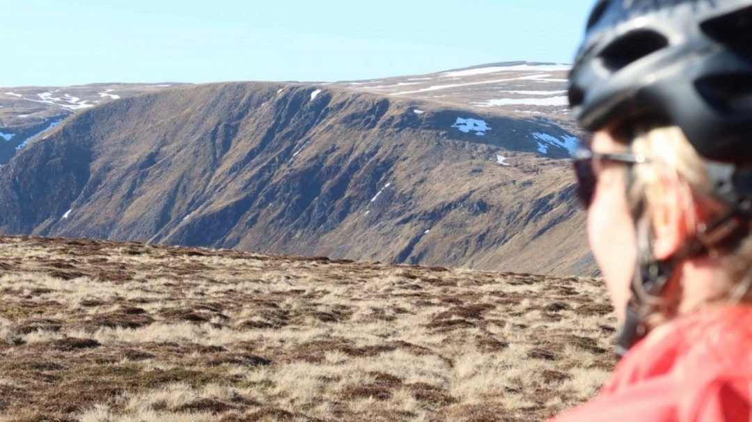
After a bridge the route follows an estate track past Tulchan Lodge and along Glenbrightly Burn and Collie Shiel Burn, with a few fords along the way. The route climbs continuously with some steep sections towards Little Glas Maol, at 973m metres the highest point of the route. The views from here into Caenlochan Glen, one of the most bio-diverse sites in Europe, are worth the effort. For those wanting to cycle the highest pass in Scotland, continue on the track instead of taking a right turn. This track leads you past Glas Maol on the Monega Pass to Cairn Claise, at an altitude of 1052m. For those not interested in more climbing (there is another ridge to come), the route follows the ridge to Monega Hill, with more breathtaking views into the glen and a 360 degree panorama view across the Cairngorm Mountains. Extra care is needed on the downhill from Monega Hill, which can be very slippery in wet conditions. The path leads back onto a gravel road to Tulchan Lodge. This loop can also be ridden separately, taking the same route as outward or the tarmac road from Auchavan back to the start.
After a bridge over the Isla (which makes an excellent lunch stop) a gravel track climbs at times steeply to The Call and on to Finarty Hill and Dun Hillocks. The views from this track are again fantastic. At Dun Hillock the route continues on the ridge southwest past Mayar and the Corrie Fee Natural Reserve (a worthwhile excursion if you make this an overnight trip). The route continues on the tops past Bawhelps and Mid Hill, and then descends past Badandun Hill.
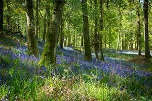
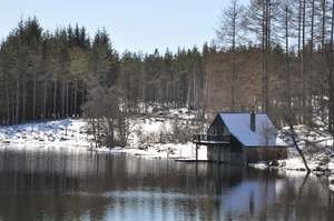
After an abandoned quarry on the left the route joins the Cateran Trail towards Auchintaple Loch. The woodland it passes was largely clear felled, although a few trees remain. A small track on the right leads down to the loch and into a native woodland, which provides shelter and another great place for a rest. The route follows along the dam and shortly afterwards a gate is reached. The route then passes a private boat house (locked) and descends on a great gravel track with more breathtaking views back into Glenisla. For the last section the route rejoins the Cateran Trail back to the start.
To download the GPX file please visit the main site
Opening times
Year round, weather dependent!
Useful links
Cateran Ecomuseum

.jpg)